Area: 564.54 sq. km
Administration (Communes/Towns): Mai Chau Town, Cun Pheo, Bao La, Pieng Xe, Xam Khoe, Mai Hich, Van Mai, Mai Ha, Chieng Chau, Na Phon, Na Meo, Tong Dau, Dong Bang, Phuc San, Tan Son, Tan Mai, Ba Khan, Thung Khe, Noong Luong, Pu Bin, Hang Kia, Pa Co, and Tan Dan
Mai Chau is a mountainous district located in the northwest of Hoa Binh province. The land is situated from 20°24 ' to 20°45' north latitude and from 104°31 ' to 105°16' east longitude. Mai Chau shares border with Tan Lac and Da Bac district in the east, Quan Hoa district (Thanh Hoa province) in the south and the west, and Moc Chau district (Son La province) in the north.

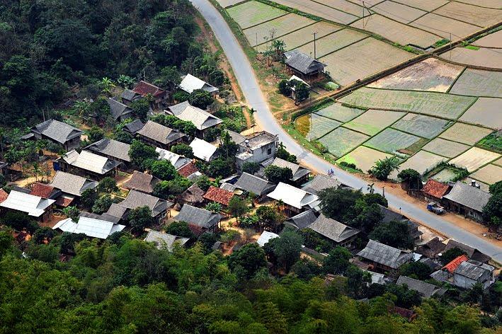
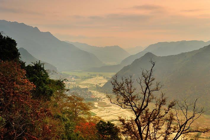
Mai Chau terrain is quite complex and fragmented by a dense system of streams and high mountains. Mai Chau topography can be divided into two distinct areas including low areas and high areas. Low areas are distributed along Xia stream, Mun stream and 15 Highway with the total area of nearly 2,000 hectares. These areas have the relatively flat terrain and the fertile soil system. On the other hand, high areas look like a belt surrounding the district with the total area of 400 km2. The high areas have many mountains and high and rugged terrains. The average altitude of the land is approximately 800 - 900 mm above the sea level. The highest point belongs to Pa Co commune with the elevation of 1,536 meters. The lowest point belongs to Mai Chau Town with 220 meters in height. The average slope is from 30 to 35 degrees. In general, Mai Chau topography is gradually lower from the northwest to southeast. The soil in Mai Chau consists of two types including red soil and humus. These two kinds of soil account for 92.02% of the natural soil area. The soil has the good structure and the relatively high natural fertility. Nonetheless, due to the steep slopes and dissected topography, the soil is easily leached.

Located in the North West Vietnam, Mai Chau weather is sharply influenced by the northwest monsoon bringing the distinct nuances of tropical climate in mountainous areas. The radiation of the land is quite low. The annual average humidity is 82%. Mai Chau climate has two distinct seasons in one year. Rainy seasons last from May to October having around 122 - 146 rainy days each year. The highest rainfall is in July and September. In this time, the region is affected by storms and Laos winds. During rainy seasons, the south wind often brings the additional moisture and water vapor to the region. Dry seasons last from November to April with the dry climate and the low humidity. Sometimes, frost, frog and freezing drizzle are also appeared in this time. The temperature fluctuation is quite high. Prevailing wind direction is northeast monsoon.

Mai Chau river system is pretty dense and diverse. The system of rivers and streams is the rich resources to supply water serving for production and daily life. Mai Chau has two main rivers, which are Black River and Ma River and four big streams including Xia stream (40 km), Mun stream (25 km), Bai Sang stream (10 km) and Co Nao stream (14 km). In addition, Mai Chau has a plenty of creeks, fountains, pond system, and natural and artificial lakes. However, due to the steep terrain, the water retention capacity of Mai Chau river system is not good. In dry seasons, some communes in Mai Chau often severely lack water such as Thung Le and Noong Luon. Besides, deforestation and steep topography sometimes cause flash floods having terribly destruction after downpours.
