Area: 5033.2 sq. km
Administration (Towns/ Districts): Huong Thuy town, Huong Tra town, Phu Vang district, Quang Dien district, A Luoi Distict.
Hue is located in geographic coordinate from 107°31' to 107°38' east longitude, and from 16° 30' to 16°24' north latitude. The city is far from Hanoi 675 km and Ho Chi Minh City 1,060 km. The four poles of Hue includes:
- The North Pole: 16°44'30'' north latitude and 107 °23'48'' east longitude in Giap Tay Village, Dien Huong Commune, Phong Dien District
- The South Pole: 15 °59'30'' north latitude and 107 °41'52'' east longitude in the southern mountain in Thuong Nhat Commune, Nam Dong District
- The West Pole: 16°22'45'' north latitude and 107°00'56'' east longitude at Pare Village, Hong Thuy Commune, A Luoi District
- The East Pole: 16°13'18'' north latitude and 108°12'57'' in the east coast of Son Cha Island, Lang Co Town, Phu Loc District

Hue has favorable natural conditions and the rich and diverse ecosystem. The city has a plenty of marvelous natural landscapes including Ngu Binh Mountain, Thien An - Vong Canh hill, Huong River (Perfume River) and so on. Hue topography consists of mountainous areas, plains, rivers and lakes. The mountainous areas account for one fourth the total area. The midland regions account for a half of the total area with the elevation of less than 500 meters. The plain area is about 1,400 sq. km.

Hue weather is a transitional zone between the south climate and the north climate of Vietnam. The city has two seasons including hot and dry seasons and cold and humid seasons (also known as rainy seasons).
Temperature: In hot seasons, due to the influence of the southwest wind, the city has high temperature from May to September. The average temperature in hot months is 27 - 29°C. Especially, in the hottest months (May and June), the temperature can reach 38 - 40°C. In rainy seasons, under the influence of the northeast monsoon wind, climate in Hue is cold and has rains. The average temperature in plains is 20 - 22°C.
Rainfall: The average rainfall is about 2,500 mm per year. Rainy seasons last from September to February. November has the highest rainfall in one year, which accounts for 30% the total rainfall. The rainfall is not evenly distributed. It increases from the east to the west and from the north to the south and focuses on some months having the high intensity, therefore, floods and erosions often happened in these months.
Humidity: The average humidity is from 85 - 86%.
Winds: Hue is affected by two main wind directions. From April to August, the city is influenced by the southwest monsoon winds. These winds often bring dry and hot atmosphere with strong evaporation causing prolonged droughts. From September to March, the northeast monsoon winds often accompanied with the cold and humid climate easily causing floods.
Storms: are often appeared from August to October.

The total length of rivers and canals in Hue is about 1,055 km with the total basin area up to 4,195 km2. The river density is 0.3 - 1 km/km2. Some main rivers in the city are Huong River, O Lau, Rao Trang, Rao Lau, Rao Mai, Ta Trach, Huu Trach, An Cuu, Nuoc Ngot, Lang Co...
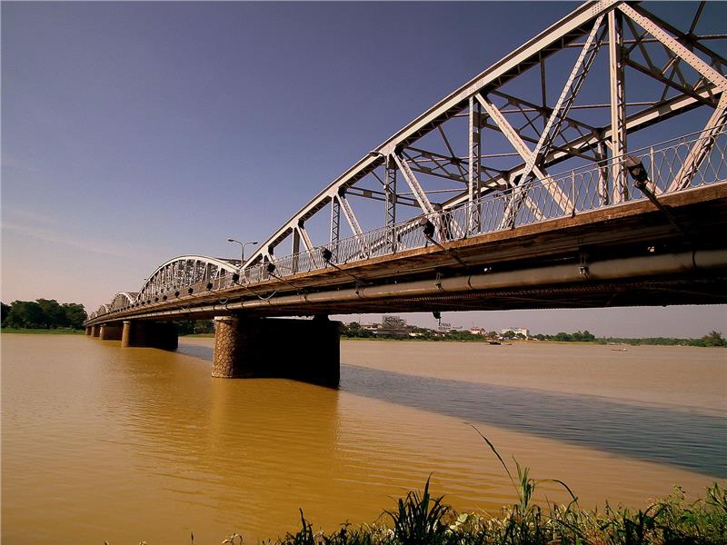
Huong River is the biggest river in Hue with two main tributaries (Huu Trach and Ta Trach) derived from Truong Son Dong Mountain. Ta Trach River flows in the direction of the northwest. It flows through Nam Dong Town and then makes a confluence with Huu Trach River at Bang Lang fork (about 3 km to the north of Minh Mang tomb). The main flow of Ta Trach River has 67 km in length. Along with Ta Trach, Huu Trach is another tributary of Huong River with the length of 60 km. The river flows in the north direction through 14 dangerous waterfalls. Huu Trach and Ta Trach meet at Bang Lang fork and form Huong River. Huong River has 33 km in length from Bang Lang to Thuan An estuary. The River flows very slowly because the water flow of Huong River is not much higher than the sea level.
Except from natural rivers, Hue city also has a variety of canals such as An Cuu (27 km), Dong Ba (3 km), Ke Van (5.5 km), etc. In addition, Hue also has the widest lagoon system not only in Vietnam but also in ASEAN named Tam Giang - Cau Hai Lagoon and An Cu Lagoon.
