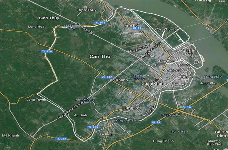
Area: 1409 sq. km
Administration: Ninh Kieu, Binh Thuy, Cai Rang, O Mon, Phong Dien, Co Do, Thot Not, Vinh Thanh

Can Tho is located in the basin of Mekong River and in the center of Mekong Delta. The city has the geographical coordinates from 105°13'38'' to 105°50'35'' east longitude and from 9°55'08'' to 10°19'38'' north latitude. Can Tho is stretching along 55 km in the western bank of Hau River. The city shares borders with An Giang Province in the north, Dong Thap and Vinh Long Province in the east, Kien Giang Province in the west, and Hau Giang Province in the south. The city is far from Ho Chi Minh City 169 km, Ca Mau City 178 km and Rach Gia City 128 km.
Following are four poles of Can Tho City:
The North Pole: Thoi Thuan ward, Thot Not district
The West Pole: Thanh Loi commune, Vinh Thanh district
The South Pole: Truong Xuan A commune, Thoi Lai district
The East Pole: Tan Phu ward, Cai Rang district
Can Tho terrain was formed mainly through the process of marine and silt sedimentation of Mekong River on the surface of 50 meters in depth. There are two kinds of sediment which are Holocene (a new type of silt) and Pleistocene (old silt). The topography of Can Tho is relatively flat which is suitable for agriculture and fishery. The average height of the city is 1 - 2 meters gradually sloping from the northeast to the southwest. The city has two main types of terrain including natural dikes along Hau River and plains.

Belonging to Mekong Delta geography, Can Tho weather has the same features in comparison to other places in the region. In details, the city has the small diurnal temperature range and the differentiation of two distinct seasons. Due to lying in the tropical monsoon climate, Can Tho has few storms with the hot and humid climate all year round, the advantages of temperature background, and the thermal radiation. Especially, the city does not have cold seasons. Rainy seasons often last from May to November while dry seasons last from December to April.
Temperature: The annual average temperature is 28°C.
Humidity: The average humidity fluctuates from 82 to 87%.
Sunny: The annual sunshine hours are 2,294.2 hours.
Rainfall: The annual average rainfall is 1,600 mm.

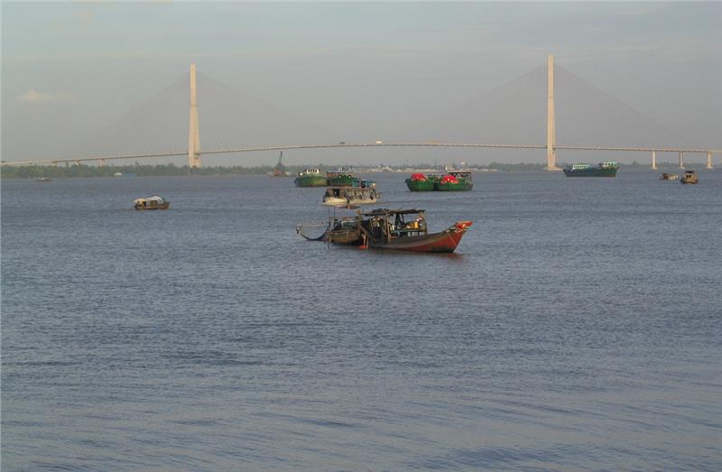
Can Tho City has a dense system of rivers and canals, with over 158 big and tributary rivers. Two main rivers of the city are Can Tho River and Hau River. Hau River flows through the city with the total length of 65 km. The total sediment load of Hau River is 35 million m3 per year. In dry seasons, the water flow in Can Tho is only 2,000 m3/s. Can Tho River is derived from inland areas in the west of Hau River. Can Tho River flows through some provinces including O Mon, Phong Dien, Cai Rang, Ninh Kieu and flows out Hau River in Ninh Kieu Pier. The River has the fresh water all year round helping the city watering in dry seasons and creating a drainage system in flood seasons. In addition, Cai River is another river of the city having 20 km in length, 600 - 700 km in width and 10 - 12 km in depth. Cai River is also a great drainage system for the city.
Except from the above rivers, there are plenty of other canals in Can Tho including Binh Thuy, Tra Noc, O Mon, Thot Not, Tham Ron and some canals in suburban districts which are Thot Not, Vinh Thanh, Co Do and Phong Dien. These canals provide the fresh water in all seasons and create favorable conditions for irrigation and land reclamation.
