Phong Nha Ke Bang is a natural beautiful landscape that the Creator has bestowed on Quang Binh, a piece of land associated with the heroic feats of the history. Here, the harmonic combination of primitive forests, Son River, and caves creates a water color painting captivating numerous local and international tourists. Phong Nha Ke Bang was organized as a Natural World Heritage by UNESCO in 2003.
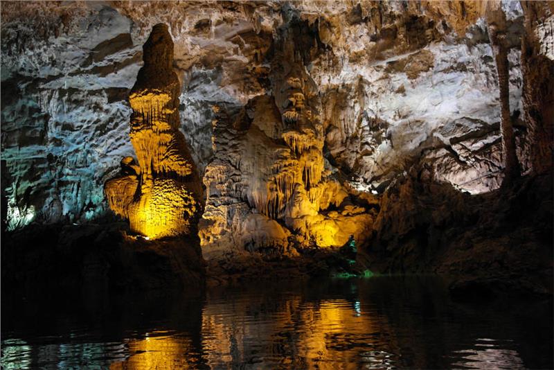
Phong Nha Ke Bang National Park is located in districts of Bo Trach and Minh Hoa, in Quang Binh, about 50km from Dong Hoi to the northwest. It is about 500km from Hanoi to Phong Nha Ke Bang. Phong Nha Ke Bang is situated in a limestone area of about 200,000 ha. The adjacent area has a limestone area of approximately 200,000 ha. The core area of the national park is 85,754 ha and the buffer zone of 195,400 ha. Phong Nha Ke Bang National Park is divided into three functional areas:
- Strict protection zone (64,894 ha)
- Ecological restoration zone (17449 ha)
- Division of Administrative Services (3,411 ha)
Like areas of North Central Coast in general, and Quang Binh province in particular, climate in Phong Nha Ke Bang is characterized by the tropical monsoon climate with hot and humid weather. The annual average temperature is 23-25°C, the highest temperature in summer is 41°C, and the lowest one in winter is 6°C. The hottest period is from June to August with the average temperature of 28; from December to February, the average temperature is 18. The annual average rainfall is about 2000-2500mm. It rains most from July to December. There are over 160 rainy days per year. The relative humidity is 84%.
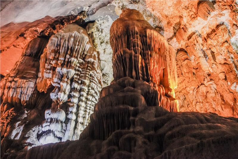
Apart from the karst system, mountainous region has the system of bedrock, clay, metaphoric rock and silt. In terms of soil, Phong Nha area has many soil from rocks of different sources. Most of them are ferralsol on limestone, acid igneous rocks, and alluvial soil in river. In Phong Nha Ke Bang, there are about large and small 300 caves. Phong Nha Cave system has been highly assessed to be a valuable cave with 4 bests: the longest underground river, the highest and widest cave entrance, the most beautiful and widest sandy beaches, the most beautiful stalactites.
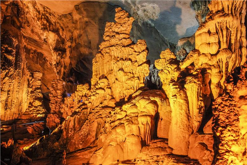
Cave system in the Phong Nha-Ke Bang is formed by the geological change inside Ke Bang limestone over 400 million years ago (in the Paleozoic). Over the important period of geology and faulting motion phases, the diversity of geology, topography - geomorphology, hydro graphic network and the excitement of cave formations in Phong Nha-Ke Bang. Phong Nha-Ke Bang has the oldest cave in Southeast Asia, with the forming time from 35 million years ago.
Inscriptions on stone walls in ancient Cham language prove that Phong Nha was discovered by Cham people in ancient times when this land was under the Kingdom of Champa. From 1550 to late 19th century, Phong Nha Ke Bang was mentioned much in literature and architecture. Before 1990, many cave expeditions of foreign and Vietnamese scientists, but little revealed about Phong Nha Cave system. In July 1924, Barton, a British explorer after surveying Phong Nha, evaluated Phong Nha Cave as best as famous caves in the world such as Padirac Cave (France), and Drach River Cave (Spain) on the spectacular beauty of the cave. In 1935, a local resident in Phong Nha accidentally discovered a dry cave lying at the altitude of 200 m, about 1000m from Phong Nha Cave. This cave is located in Ke Bang limestone massif of Son Trach Commune in Bo Trach District. This cave is as spectacular as Phong Nha Cave, but there is no underground river. The exploration and study results bring a comprehensive understanding of the cave system in Phong Nha-Ke Bang. It has been the basis for protecting, planning and developing tourism as well as completing documents to submit as a world natural heritage.
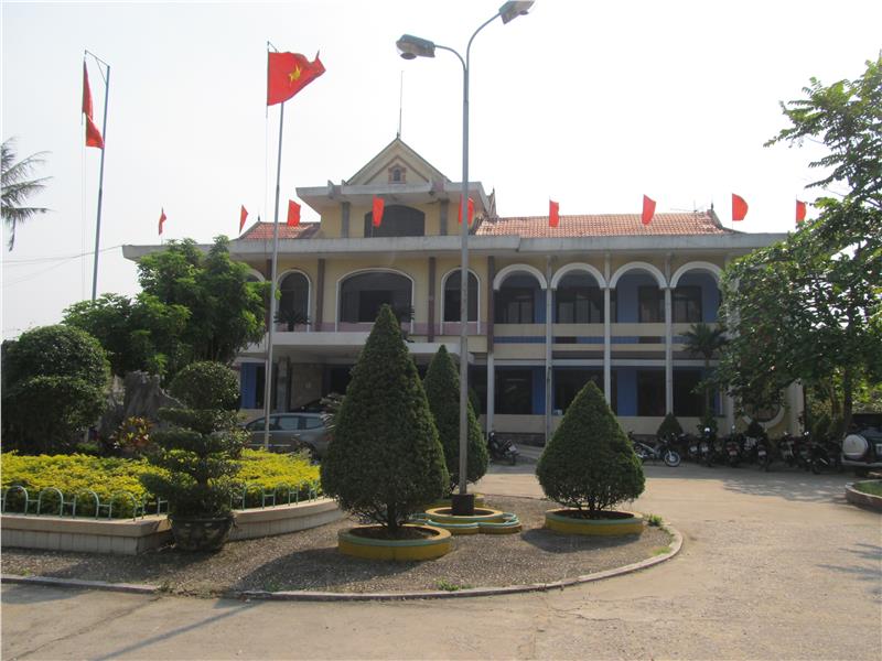
Phong Nha Ke Bang National Park is situated in communes of Tan Trach, Thuong Trach, Phuc Trac, Xuan Trach and Son Trach of Bo Trach District (in Quang Binh). There are 28 commune and two districts which are distributed evenly in all area: plain, mountainous, midland, and coastal areas. Bo Trach District borders Tuyen Hoa and Quang Trach districts in the north, Minh Hoa District in the northwest, Dong Hoi City in the southwest, Quang Ninh District in the south, the South China Sea in the east, and Khammuane (Laos). Bo Trach District has an area of 2123.1 sq. km. The west of Phong Nha Ke Bang National Park is adjacent to the Hin Namno National Biodiversity Conservation Area in Khammuane (Laos).
The population of Quang Binh is 846,924 people (according to the statistics in 2009). 178,464 of the population are residing in Bo Trach District. There are 24 ethnic groups living together in the region. Kinh people comprise the majority, followed by Van Kieu and Chut ethnic groups. Other ethnic groups have populations of less than 100 people in each group.
In addition to the second-to-none cave system in the world, Phong Nha Ke Bang also contains national historical and cultural values. By the early twentieth century, the British and French explorers and scholars came to Phong Nha Ke Bang. Apart from beautiful landscapes and values of tourism, they discovered a number of ancient Cham and Vietnamese monuments such as Cham altar, Cham characters carved on rocks, bricks, stone statues, Buddha statues, and pottery ... In 1995, Vietnam Institute of Archaeology believed that Phong Nha Cave had a sign of an utmost important archaeological ruins. Perhaps, the vestiges in Bi Ky Cave used to be a Cham mosque during the IX- XI centuries. Here, pieces of enameled Cham pottery were also found. Besides, there are lotus-shaped ceramic patterns in colors of turquoise and light pink of rabbit fur.
Phong Nha Ke Bang is the residence of some ethnic groups as Arem, Ruc, Sach, May, Ma Lieng, etc. People in Phong Nha Ke Bang used to use Arem language which has a close relation with the language of modern Vietnamese people. Nowadays, people in this area communicate with each other by modern Vietnamese language. In some minority ethnic groups, they speak Vietnamese as their second language, and still communicate by mother tongue in their living area.
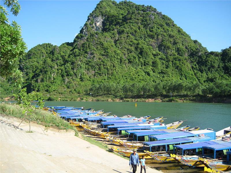
Bo Trach District is one of few districts having special geographical position. It is located in the north gateway of Dong Hoi City, the capital of Quang Binh province. With an important geographical position, Bo Trach District has more favorable conditions to develop a comprehensive society and economy, to acquire advances of science and technology to apply for production and life.
In the recent period (2006-2010), the district has achieved relatively good results. Significantly, the annual economic growth rate was 11.94% (agriculture, forestry and fisheries: 35.89%; industry and construction: 26.04% services: 38.07%; total food production per capita reached 45.7 thousand tons per year (114.3%). The quantity of fisheries and aquaculture average annual 13470 tons, 15.2% higher than the plan. Gross average annual budget is 73.7 billion (125.8%). In the period of 2000-2005, the figure is 30.1 billion. In 2010, it reached 80 billion (109.6%). The average capita income 2010 was 13.5 million. In agriculture, agricultural production structure is gradually changed in right directions. Besides, mono culture in production is limited. Many areas of intensive crops and livestock are expanded. In forestry, the structure has been shifted from mainly exploiting to protecting, regenerating and planting trees to preserve and develop of forest resources. In the field of aquaculture and seafood processing, positive changes area seen in cage fish farming, brackish water shrimp and crab farming, and sand shrimp farming.
In addition, the farm economy of the district has determined its position in the commodity economy. There are 582 farms in this area, of which 352 arable lands, 14 farms, 76 forestry farms and 124 fishery farms. Besides, industry and handicraft industry and rural industries flourish with advantages of materials: producing building materials, agro-forestry and seafood products ... and some new materials (composites). In terms of service, commerce, and tourism, over the years, these sectors are developed relatively, creating solid strength. In particular, Phong Nha Ke Bang is the most significant point in tourism development in this region. The number of tourists to Phong Nha Ke Bang increases by 16.03% annually. Ca Roong - Noong Ma border gate is open, creating favorable conditions for cultural exchange and trade between regions.
Phong Nha Ke Bang is situated in an important political position which is adjacent to Laos, the friendly neighbor of Vietnam. Here is a part of Truong Son Mountain Range that plays an important part in politics of North Central Vietnam in the west gateway. This national part is also near Cha Lo (Naphao) border gate between Vietnam and Laos. This border gate not only plays its role in Quang Binh economy, but also in political field.
Society
The buffer zone of Phong Nha Ke Bang National Park is the residence of 12 communes with a total area of 1479.45 km ². People primarily reside along major rivers such as Chay River, Son River and valleys having streams in the east and northeast of the park. These areas belong to remote area of Quang Binh. The conditions of infrastructure such as roads, electricity, education, health are underdeveloped. Residents here live mainly on agriculture and forest exploitation. The poverty rate fell an average of 3.8% per year, bringing the poverty rate to below 5% at the end of 2010. On average, about 3800 workers have jobs annually. 28 communes and towns meet the national standards for health. All children in this area have chances to go to school. Labor force in this area has a relatively good skill. The sanity in Phong Nha Ke Bang is ensured well.
Tourism
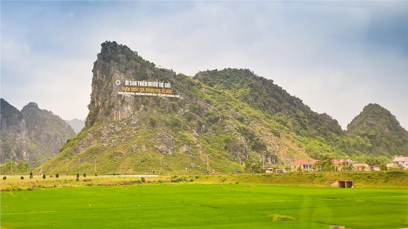
There are famous tourist attractions in Phong Nha Ke Bang from tremendous caves, diverse flora and fauna system, traditional cultural values and local life of people. Phong Nha Ke Bang appeals tourists by outstanding karst system with marvelous caves as Phong Nha Cave, Tien Son Cave, Thien Duong Cave (Paradise Cave), and Son Doong Cave. Phong Nha Cave is the most outstanding cave in Phong Nha Ke Bang with its unique aesthetic values. In particular, after almost 20 years of exploring Phong Nha Ke Bang tourism, tourists have the opportunity to experience 7 best criteria of Phong Nha Cave which are voted by the British Royal Cave Research Association. With a length of 7729m, Phong Nha Cave is one of the world's longest wet cave. Located near Phong Nha Cave, Tien Son Cave was discovered in 1935. The first explorer set foot on this cave is a French female archaeologist - Colani. Tien Son cave has a length of nearly 1km. The entrance of this cave is about 20m high. The more people enter this cave, the more majestic and tremendous beauty of this cave with magical stalactites is. Son Doong Cave is a newly discovered cave in Phong Nha Ke Bang. It is seen as the largest cave in the world. The biggest chamber of Son Doong Cave is over five kilometers long, 200 meters high and 150 meters wide. This national park also lures tourists into a primitive scenery of the largest vegetation with tropical moist evergreen forest on limestone. This national park is covered mostly by forests, 92.2% of which is intact primary forest. Here is also home to 98 families, 256 genera and 381 species of vertebrates. A large number of animal species are listed in Vietnam Red Book and many other species named in the World Red Book of Endangered Species.
Festivals
There are many attractive festivals in Quang Binh with unique features of Phong Nha Ke Bang. Many cultural activities of ethnic minority groups in this region take place throughout the year. Annually, Phong Nha Ke Bang Festival is organized in April. The first festival was held in 2006. Rituals in this festival include the ancient offering water, asking fairy water in Phong Nha Cave. Meanwhile, the festival will typified by interesting traditional folk games and performances, appealing many tourists.
