Lao Cai is a mountainous province, located in the border of the midland and mountainous region in the Northwest Vietnam, one of the most potential regions of Vietnam.
Geographical location: Lao Cai province is a mountainous border, located in the middle of Northeast and Northwest of Vietnam, about 296 km away from Hanoi under the railway and 345 km by road. The province has the natural area of 6383.88 km2 (accounting for 2.44% of the country and ranking 19th among 64 provinces and cities of the area). Lao Cai is adjacent Ha Giang province to the east, Yen Bai province to the south, Lai Chau province to the west and Yunnan - China to the north with the border of 203km long.
Terrain: Terrain in Lao Cai is very complex, highly stratified altitudes, partitioned strongly. The two main mountain ranges are Hoang Lien Son and Elephant that lie to the northwest - southeast create the lowlands and midlands between two mountain ranges and an area in the west of Hoang Lien Son. There are also many diversified smaller mountains divided to create different sub-climate zones. The terrain is divided fairly obvious, of which the height from 300m-1000m occupies a large area of the province. The highest point is Fansipan peak located on Hoang Lien Son range with 3.43m high above the sea level; the second point is Ta Giang Phinh with the height of 3090m. The strip of land along the Red River and Chay River has the lower height, less rugged terrain.
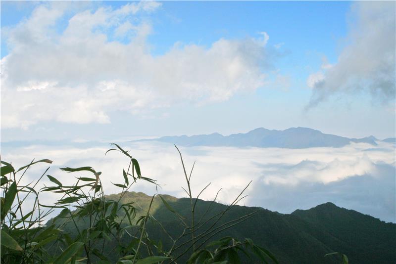
Climate: Lao Cai has a tropical monsoon climate, but the province is located deeply in the continent governed by the complex topography, so the weather has the changes and differences in time and space. The Lao Cai climate is divided into 2 distinct seasons: the rainy season from April to October and the dry season from October to March. The average temperature is in the mountainous region is about 150C - 200C. The average rainfall is from 1,800 mm to more than 2.000mm. The average temperature in the lowland areas is about 230C - 290C, the average rainfall is from 1.400mm - 1.700mm. Fog and frost are the common phenomenon in the province.
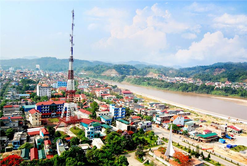
Lao Cai is an ancient land; its terrain appearance was formed 50 to 60 million years ago. More than ten thousand years ago, the human were present here. During the Hung Vuong period, Lao Cai province located in Tan Hung, an economic and political center in the Red River upstream. When making the map, the French wrote Lao Cai as Lao Kay. The noun “Lao Kay” was used in the text and the seal. However, in the folk communication, people still called Lao Cai. After Lao Cai province was liberated (November 1950), the name “Lao Cai” was uniformly called to this day.
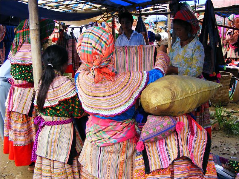
According to the statistics in 2009, the population of Lao Cai province is 615.620 people, accounting for 5.5% of population in the northern midland and mountainous region, 0.7% population of the country. The growth rate of population in the period from 2005-2009 was 1.41%/year, reducing 0.42% over the period from 2000-2005 (1.83%/year).
Lao Cai province gathered by 25 ethnic groups, among them the ethnic minorities accounts for 64,09% the population of the province. The distribution of the ethnic minorities comprises Kinh people - 35.9%, Hmong - 22.1%, Tay - 15.84%, Dao - 14.05%, Giay - 4.7%, Nung - 4.4% and the rest is other ethnic minorities such as Phu La, San Chay, Ha Nhi, La Chi…The Kinh People cover the majority of Lao Cai population, so the Vietnamese is the official language of Lao Cai. In addition, there are languages of the ethnic minorities as Hmong – Dao, Tay – Thai, Han – Tang…
Lao Cai province consists of Lao Cai city and 8 districts as Sapa, Bat Xat, Bao Yen, Bao Thang, Si Ma Cai, Van Ban, Muong Khuong, Bac Ha with 164 communes, towns. Among them, there are 138 remote communes and border region.
Lao Cai People’s Council is the agency of state power in the province, deciding the guidelines and measures to promote the local potential, the economic development, to strengthen the national defense and security, to constantly improve the material and spiritual life of local people and to fulfill the obligations of the country. The People’s Committee in districts of Lao Cai is the executive body of the People’s Council and state administrative agencies in the province.
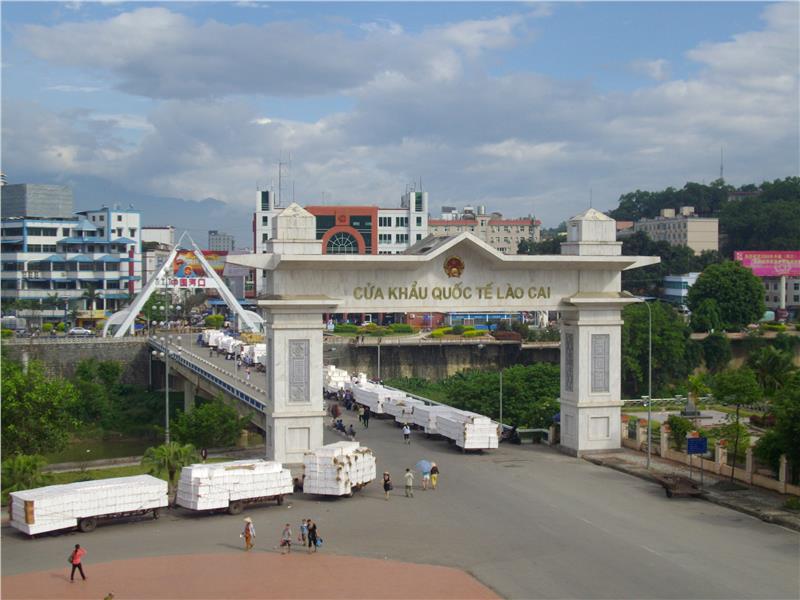
Lao Cai is one of the provinces consecutively ranked top in the provincial competitiveness index in recent years. In the ranking of the provincial competitiveness index of Vietnam in 2011, Lao Cai ranked the 1st among 63 provinces and cities.
Lao Cai has the favorable geographical position that has 2 rivers Red river and Chay River, the international border gate, so Lao Cai economy has many potentialities and advantages for the development. Lao Cai province is rich in mineral resources and forest resources. This is the basic to develop agro-forestry products. The Lao Cai – Ha Khau border gate is located on the economic corridor Kunming – Hai Phong, the big and important gateway to develop the trade and tourism between Vietnam and the southwest of China (including 11 provinces, cities with the area more than 5 million km2 and a population of over 380 million people). This is also the shortest and most convenient way from Yunnan – China to Hai Phong port and connecting with the Southeast Asia. Lao Cai international border converge all kinds of transports such as the railway, road, waterway and even the airway in the future. This is the only international border gate of Vietnam located right in the city that has the relatively good infrastructure and services. Currently, the Lao Cai international border gate has been focused on building a civilized and modern border gate that is enough condition to become major hub between Vietnam with China and the ASEAN countries.
Health: In recent years, in addition to the economic development, Lao Cai province has pay attention to the development of health and education. The province has focused on upgrading the facilities and infrastructure of the hospitals to meet the demand for health care of people.
Education and training: The province has consolidated, developed and diversified the types of schools, strongly developed the school system, the boarding class, the size of high school education, improved the quality of the education. Currently, the province has 661 educational units, including 161 kindergartens, secondary schools and high schools achieving the national standard. The education in the mountainous areas is particularly interested to shorten the gap between the advantageous region and the difficult region.
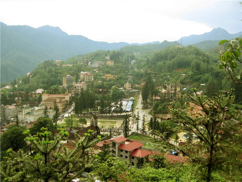
With more than 25 ethnic groups, Lao Cai has become the abundant land in the cultural identity, the historical tradition and cultural heritage. The rich in the lives of ethnic people has created the unique identity of Lao Cai. As a mountainous province, Lao Cai province still keeps the diverse and clean environmental landscape. This is an important factor to create an ideal tourist destination for domestic and international tourists.
The natural gifts for Lao Cai many famous scenic spots as Sapa, Bac Ha, Bat Xat, Muong Khuong… In particular, Sapa is one of 21 national tourist destinations of Vietnam. The district is located on the average altitude of 1200m – 1800m; has cool climate year round and the landscape of stone mountains and waterfalls. This is also the home to many traditional cultural activities of the ethnic minorities such as mountainous markets, Sapa love market. The number of tourists to Lao Cai in 2002 was 350.000 arrivals, visitors entering and exiting from the international border gate in 2002 reached 1.4 million visitors.
Hoang Lien Son mountain range has Fansipan peak – the roof of Vietnam and the Hoang Lien Nature Reserve attracting many scientists and visitors. In addition, Lao Cai has many historical sites, natural caves and agro-ecological zones such as Bac Ha plums, temperate vegetables, precious medicinal planes, salmon, sturgeon…
Lao Cai province plays the role as the tourist center of the sub- Northern mountainous region. The province is also the gateway adjacent to Yunnan province – China. This is one of the favorable conditions for Lao Cai to develop tourism sector. Every year, there are 2.5 million international arrivals to Lao Cai. The majority of visitors to Yunnan want to travel Vietnam through international border gate and vice versa.
Festivals
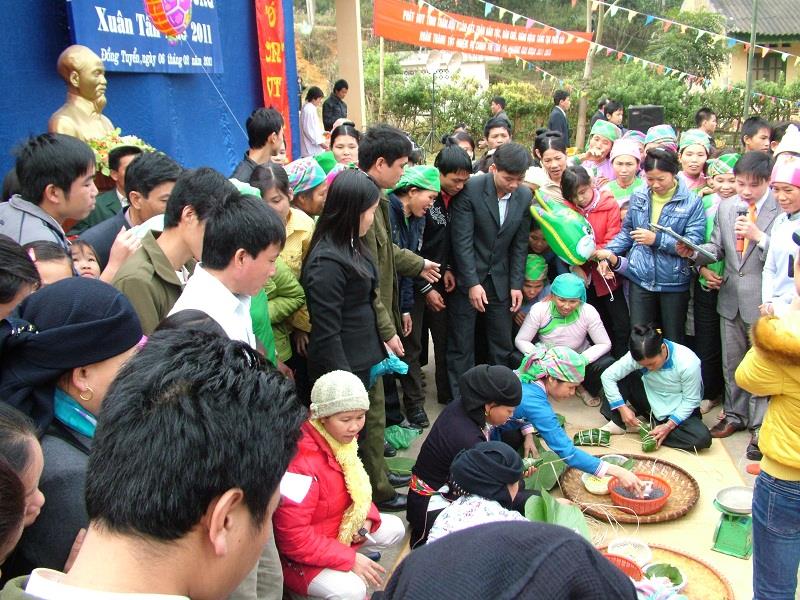
Traveling to Lao Cai, tourists not only contemplate the beautiful landscapes but also participate in the traditional festivals of the mountainous ethnic groups. Long Tong Festival in Ta Van (Sapa) is held in January every year. In these days, Muong Hoa valley steeps in the color. Long Tong is the festival praying for the peaceful nation, the comfortable life, for favorable weather.
“Tet Nhay” or “Dance festival” is important festival and elaborately prepared of Dao people in Ta Van. Before the festival, young men spend their time to practice dances, girls dye indigo, embroider new shirts. The festival starts from the end of fifth hour to the tenth hour with forms of folk art. It is the dance interwoven with the music. It is the art of words about the legend of lineage, ancestry merits... Dance festival in Lao Cai of the Red Dao is rich and unique identity and imbued with the humanity.
In addition, there are many unique festivals attracting tourists when traveling Lao Cai such as Roong Pooc festival, Gau Tao festival, Fishing festival…
